
Reliable property information has played a big role in how real estate professionals, developers, and researchers work.
Having the right skills and resources allows you to get extensive land records that used to require looking through old filing cabinets or using expensive third-party services.
Being able to access accurate land parcel information allows you to choose wisely and prevents you from running into problems that could stop projects early on.
It teaches you how to go about finding and checking facts on properties online. Let’s get in detail.
What is Land Parcel Data?
Specific information about plots of land, like ownership records, boundaries, zoning details, and allowable practices, can be found in land parcel data.
Each parcel has identifiers that make it different from the surrounding land. They cover assessment of taxes, limitations on developing the property, legal easements, and transfer of ownership in the past, all things that can change the value and opportunities for the future use of the property.
Why Data Accuracy Matters
Many real estate professionals lose thousands of dollars every year due to inaccuracies, failed business, difficulties in court, and delayed projects.
Using old or incorrect data to make choices can cause the discovery of zoning violations, boundaries in dispute, or issues with ownership later, after investing much time and money.
Professional developers realize that it is better to check all details at the outset to avoid problems and surprises later on. When you use correct data, it helps your discussion with clients and partners and proves trustworthiness.
Top Sources for Online Land Parcel Information
Multiple platforms offer access to property records, but quality and completeness vary significantly between sources.
1. Government Database Access
County assessor offices maintain the most authoritative property records in most jurisdictions. These databases typically include current ownership information, tax assessments, zoning designations, and recorded transactions. Most county websites offer free access to basic property searches, though interface quality varies widely.
State-level portals often provide standardized data formats across multiple counties, making regional research more efficient. Federal databases like those maintained by the Bureau of Land Management cover public lands and federal property transfers.
2. Commercial Data Services
Private companies aggregate government records with additional analytical tools and user-friendly interfaces. These services often include historical trend analysis, comparable sales data, and integration with mapping software that government sites lack.
According to the U.S. Census Bureau, commercial providers frequently offer more comprehensive search capabilities and faster data updates than public databases. While subscription fees apply, the time savings and enhanced functionality often justify costs for active professionals.
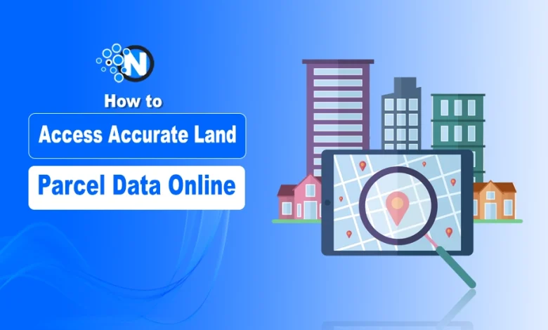
3. Using Mapping Platforms
Combining mapping and detailed records has made property research much more efficient with the help of Geographic Information System (GIS) tools. Platforms allow users to check satellite images and parcel boundaries, measure distances accurately and layer different data sets for a wide look at the area.
Current maps are often built with street views, information about the local population, and environmental hazard information, which gives insights that your basic maps won’t list.
Essential Steps for Verifying Data Accuracy
Smart real estate professionals use more than a single source when they need to make an important decision. Checking data in various databases allows you to identify problems and check that the data is trustworthy before moving on with your plans.
The first step is to look at how much land each parcel has, how its borders are described, and who currently owns it on each platform. Record and update the dates regularly; sometimes, property information changes quickly because of property transactions, subdivisions, or changes to zoning.
For information that seems unclear, start with what the government sources say, but still reach out to local authorities to get help with tough cases. Speaking with officials in those offices can be helpful for your later research needs.
Legal Considerations and Best Practices
Anyone who uses public land records must follow privacy rules and be responsible with the information. Even though listings are usually available to anyone, users should not break fair housing laws or target individuals based on protected characteristics.
Be sure that your use of property information meets regulations and is industry standard for your locality. While working on research for clients, remember to keep confidentiality and use the information exclusively for the agreed reasons. Consider talking to law experts who specialize in property matters when you have questions about data use.
Practical Applications Across Industries
Property data serves numerous professional applications across different sectors.
1. Real Estate Development
Developers rely on comprehensive property information to identify suitable acquisition targets, understand zoning constraints, and estimate development costs before making purchase decisions. Access to accurate data helps evaluate project feasibility and secure financing approval.
2. Urban Planning
City planners use land use data to design infrastructure improvements, plan new developments, and ensure community growth aligns with long-term municipal goals. Historical property information helps predict future development patterns and infrastructure needs.
3. Environmental Research
Scientists and conservationists analyze land use changes over time to study environmental impacts and guide preservation efforts. Property records help track development patterns that affect wildlife habitats, water quality, and air pollution levels.
4. Investment Analysis
Real estate investors leverage property data to identify undervalued opportunities, assess market trends, and evaluate rental income potential in specific geographic areas. Historical sales data and zoning information help predict future appreciation potential.
Common Data Access Challenges
Many users encounter frustrating obstacles when searching for property information online. Outdated government websites, inconsistent data formats, and limited search functionality can significantly slow research progress and increase frustration levels.
Technical issues often arise from overloaded servers during peak usage periods or outdated browser compatibility requirements. Some databases require specific plugins or software versions that create additional barriers for users.
The solution involves developing systematic approaches to data collection, including maintaining bookmarks for reliable sources, learning platform-specific search techniques, and keeping organized records of research findings for future reference.
Future Trends in Land Parcel Data Access
Artificial intelligence and machine learning technologies are beginning to enhance property data analysis through automated quality checking and predictive analytics. These advances promise more intuitive search interfaces and faster identification of relevant information.
Blockchain technology can revolutionize property record keeping by creating tamper-proof ownership histories and streamlining transfer processes. While still emerging, these innovations could significantly improve data reliability and reduce transaction costs.
Mobile applications are also expanding access to property information to allow field research and real-time data verification during site visits and client meetings.
Key Takeaways
Mastering online property research requires understanding available sources, developing verification processes, and staying current with technological advances. Success comes from combining free government resources with strategic use of commercial services based on specific research needs and budget constraints.
The investment in proper data research techniques pays dividends through reduced risk, better project outcomes, and increased confidence in property decisions. As technology continues evolving, professionals who develop strong research skills will maintain competitive advantages in dynamic real estate markets.